Medieval trade routes
| dc.coverage.temporal | other date: dates depicted in map, ca. 400-ca. 1400 | en_US |
| dc.creator | unknown (undetermined) | en_US |
| dc.date | ca. 400-ca. 1400 | en_US |
| dc.date.accessioned | 2006-11-27T20:14:54Z | |
| dc.date.available | 2006-11-27T20:14:54Z | |
| dc.date.issued | 350 | en_US |
| dc.identifier | 100514 | en_US |
| dc.identifier.uri | http://hdl.handle.net/1721.3/13839 | en_US |
| dc.description | full view | en_US |
| dc.relation.ispartof | 128695 | en_US |
| dc.subject | Maps | en_US |
| dc.subject | Islam -- History | en_US |
| dc.subject | Trade routes | en_US |
| dc.subject | Europe --History | en_US |
| dc.subject | Middle East --History | en_US |
| dc.subject | Commerce --History | en_US |
| dc.subject | Civilization, Islamic | en_US |
| dc.subject | Historical geography --Maps | en_US |
| dc.subject | Middle Ages --History | en_US |
| dc.subject | Medieval to early modern culture | en_US |
| dc.title | Medieval trade routes | en_US |
| dc.type | Image | en_US |
| dc.rights.access | All rights reserved | en_US |
| vra.culturalContext | Islamic | en_US |
| vra.culturalContext | European | en_US |
| vra.worktype | Map | en_US |
| dc.contributor.display | unknown (undetermined) | en_US |
Files in this item


This item appears in the following Collection(s)
-
Architecture, Urban Planning, and Visual Arts
Online Image Collection
Related items
Showing items related by title, author, creator and subject.
-
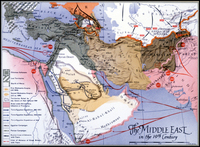
Middle East in the 19th Century
(1800)