| dc.coverage.spatial | Creation Site: California, United States, North and Central America, | en_US |
| dc.coverage.temporal | 2001 (creation) | en_US |
| dc.creator | Gilchrist, Scott | en_US |
| dc.date | 2001 | en_US |
| dc.date.accessioned | 2013-07-11T20:48:44Z | |
| dc.date.available | 2013-07-11T20:48:44Z | |
| dc.date.issued | 2001 | en_US |
| dc.identifier | 224310 | en_US |
| dc.identifier.other | archrefid: 568 | en_US |
| dc.identifier.uri | http://hdl.handle.net/1721.3/132932 | |
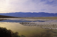
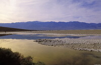
| dc.description | View looking west over the salt flats, near Badwater; Death Valley is a valley in the U.S. states of California and Nevada, and is the location of the lowest elevation in North America at 282 ft (86 m) below sea level. It is one of many places on land which fall below mean sea level. Located southeast of the Sierra Nevada range in the Great Basin and the Mojave Desert, it constitutes much of Death Valley National Park. It runs north-south between the Amargosa Range to the east and the Panamint Range to the west; the Sylvania Mountains and the Owlshead Mountains form its northern and southern boundaries, respectively. It has an area of about 3,000 square miles (about 7,800 square km).Badwater, located within Death Valley, is the specific location of the lowest point in North America. Source: Wikipedia; http://en.wikipedia.org/wiki/Main_Page (accessed 1/30/2008) | en_US |
| dc.rights | © Scott Gilchrist, Archivision, Inc. | en_US |
| dc.subject | contemporary (1960 to present) | en_US |
| dc.subject | landscapes | en_US |
| dc.subject | parks (recreation areas) | en_US |
| dc.subject | Twenty-first century | en_US |
| dc.title | Death Valley: Topographic Views | en_US |
| dc.type | image | en_US |
| dc.rights.access | Licensed for educational and research use by the MIT community only | en_US |
| dc.identifier.vendorcode | 2A2-US-NP-DV-B2 | en_US |
| vra.culturalContext | American | en_US |
| vra.technique | photography | en_US |
| vra.worktype | photograph | en_US |
| vra.worktype | topographical view | en_US |
| dc.contributor.display | Scott Gilchrist (Canadian photographer, born 1960) | en_US |


