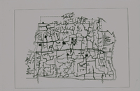
City of Cairo
| dc.coverage.spatial | Site: Cairo (Egypt) | en_US |
| dc.coverage.temporal | creation date: founded, 641/20 AH | en_US |
| dc.creator | unknown (undetermined) | en_US |
| dc.date | 641/20 AH | en_US |
| dc.date.accessioned | 2013-06-10T20:32:03Z | |
| dc.date.available | 2013-06-10T20:32:03Z | |
| dc.date.issued | 641- | en_US |
| dc.identifier | 211010 | en_US |
| dc.identifier.uri | http://hdl.handle.net/1721.3/130671 | |
| dc.description | map, 19th century plan, with medieval walls | en_US |
| dc.relation.ispartof | 125931 | en_US |
| dc.subject | Cairo (Egypt) | en_US |
| dc.subject | Cities and towns | en_US |
| dc.subject | Capital cities | en_US |
| dc.subject | Islamic cities and towns | en_US |
| dc.subject | Land use, Urban | en_US |
| dc.subject | City planning | en_US |
| dc.subject | Historical geography --Maps | en_US |
| dc.title | City of Cairo | en_US |
| dc.title.alternative | City of al-Qahirah | en_US |
| dc.title.alternative | Ville du Caire | en_US |
| dc.type | Image | en_US |
| dc.rights.access | All rights reserved | en_US |
| vra.culturalContext | Egyptian (modern) | en_US |
| vra.culturalContext | Islamic | en_US |
| vra.technique | construction | en_US |
| vra.worktype | City | en_US |
| dc.contributor.display | unknown (undetermined) | en_US |
Files in this item
This item appears in the following Collection(s)
-
Architecture, Urban Planning, and Visual Arts
Online Image Collection


