| dc.coverage.spatial | Creation Site: Bath, England, United Kingdom, Europe, | en_US |
| dc.coverage.temporal | ca. 2000 (creation) | en_US |
| dc.creator | Gilchrist, Scott | en_US |
| dc.date | 2000 | en_US |
| dc.date.accessioned | 2013-05-10T19:20:46Z | |
| dc.date.available | 2013-05-10T19:20:46Z | |
| dc.date.issued | 2000 | en_US |
| dc.identifier | 216055 | en_US |
| dc.identifier.other | archrefid: 273 | en_US |
| dc.identifier.uri | http://hdl.handle.net/1721.3/123684 | |
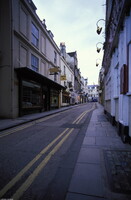
| dc.description | Looking down Great Pulteney Street; Famous for mineral springs discovered by Romans in the first century and revived in the 18th century; captured by Saxons 577; abbey was built in the 10th century; was important wool center by the 12th century; noted for Royal Cresent (1767-1775), Prior Park (1735-1743) by Robert Adam and for its Roman ruins. Source: Thesaurus of Geographic Names (Notes) [website]; http://www.getty.edu/research/conducting_research/vocabularies/tgn/ (accessed 2/7/2008) | en_US |
| dc.rights | © Scott Gilchrist, Archivision, Inc. | en_US |
| dc.subject | architectural exteriors | en_US |
| dc.subject | cityscapes | en_US |
| dc.subject | landscapes | en_US |
| dc.subject | Roman Empire | en_US |
| dc.subject | Twenty-first century | en_US |
| dc.title | Bath: Topographic Views | en_US |
| dc.type | image | en_US |
| dc.rights.access | Licensed for educational and research use by the MIT community only | en_US |
| dc.identifier.vendorcode | 1A2-E-B-BO-E3 | en_US |
| vra.culturalContext | British | en_US |
| vra.technique | photography | en_US |
| vra.worktype | photograph | en_US |
| vra.worktype | topographical view | en_US |
| dc.contributor.display | Scott Gilchrist (Canadian photographer, born 1960) | en_US |


