| dc.coverage.spatial | Site: New York (United States) | en_US |
| dc.coverage.temporal | other date: purchase date, 1626, other date: incorporated as city, 1653, other date: renamed New York, 1664 | en_US |
| dc.creator | Unknown | en_US |
| dc.date.accessioned | 2013-05-06T17:43:38Z | |
| dc.date.available | 2013-05-06T17:43:38Z | |
| dc.date.issued | 2013-05-06 | |
| dc.identifier | 210919 | en_US |
| dc.identifier.uri | http://hdl.handle.net/1721.3/120560 | |
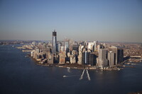
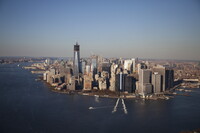
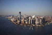
| dc.description | aerial view, Lower Manhattan suffered extensive infrastructure damage from street and tunnel flooding; Freedom tower exceeds Empire State in height, 11/14/2012 | en_US |
| dc.format.medium | asphalt | en_US |
| dc.format.medium | glass (material) | en_US |
| dc.format.medium | masonry | en_US |
| dc.format.medium | steel | en_US |
| dc.format.medium | stone | en_US |
| dc.format.medium | wood (plant material) | en_US |
| dc.relation.ispartof | 129512 | en_US |
| dc.rights | © Alex S. MacLean / Landslides | en_US |
| dc.subject | Urban planning | en_US |
| dc.subject | New York (N.Y.) | en_US |
| dc.subject | Cities and towns --Growth | en_US |
| dc.subject | Urban areas | en_US |
| dc.subject | Land use, Urban | en_US |
| dc.subject | City planning | en_US |
| dc.subject | Architecture --United States | en_US |
| dc.subject | Skyscrapers | en_US |
| dc.subject | Aerial views | en_US |
| dc.subject | Hurricanes | en_US |
| dc.subject | Aerial photography --United States | en_US |
| dc.subject | Hurricane Sandy, 2012 | en_US |
| dc.title | New York City | en_US |
| dc.title.alternative | New Amsterdam | en_US |
| dc.type | Image | en_US |
| dc.rights.access | Licensed for educational and research use by the MIT community only | en_US |
| dc.identifier.vendorcode | 121114-0566.dng | en_US |
| vra.culturalContext | American | en_US |
| vra.technique | construction | en_US |
| vra.worktype | City | en_US |
| dc.contributor.display | American | en_US |


