| dc.coverage.spatial | Creation Site: Boston, Massachusetts, United States, North and Central America, | en_US |
| dc.coverage.temporal | ca. 2003 (creation) | en_US |
| dc.creator | Gilchrist, Scott | en_US |
| dc.date | 2003 | en_US |
| dc.date.accessioned | 2013-04-12T18:03:12Z | |
| dc.date.available | 2013-04-12T18:03:12Z | |
| dc.date.issued | 2003 | en_US |
| dc.identifier | 207888 | en_US |
| dc.identifier.other | archrefid: 912 | en_US |
| dc.identifier.uri | http://hdl.handle.net/1721.3/115756 | |
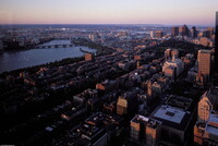
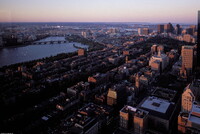
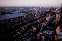
| dc.description | Aerial view, from the top of the Prudential Tower, looking northeast towards Beacon Hill, with the Back Bay in the foreground; The Charles River is a small, relatively short river in Massachusetts, USA, that separates Boston from Cambridge and Charlestown. It is fed by about 80 brooks and streams and several major aquifers as it flows snakelike for 80 miles (129 km), starting at Echo Lake in Hopkinton, through 22 cities and towns in eastern Massachusetts before emptying into Boston Harbor. It is the most densely populated river basin in New England. Source: Wikipedia; http://en.wikipedia.org/wiki/Main_Page (accessed 1/30/2008) | en_US |
| dc.rights | © Scott Gilchrist, Archivision, Inc. | en_US |
| dc.subject | architectural exteriors | en_US |
| dc.subject | cityscapes | en_US |
| dc.subject | contemporary (1960 to present) | en_US |
| dc.subject | City planning | en_US |
| dc.subject | Rivers | en_US |
| dc.subject | topographical views | en_US |
| dc.subject | Twenty-first century | en_US |
| dc.title | Boston: Charles River; Topographic Views | en_US |
| dc.type | image | en_US |
| dc.rights.access | Licensed for educational and research use by the MIT community only | en_US |
| dc.identifier.vendorcode | 1A2-US-B-BCR-A3 | en_US |
| vra.culturalContext | American | en_US |
| vra.technique | photography | en_US |
| vra.worktype | photograph | en_US |
| vra.worktype | topographical view | en_US |
| dc.contributor.display | Scott Gilchrist (Canadian photographer, born 1960) | en_US |


