Harlem: Urban and Topographic Views
Gilchrist, Scott

Download1A2-US-NY-HO-B6_cp.jpg (740.9Kb)
Date
1995-2000Description
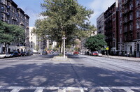
View on Frederick Douglass Blvd, looking north a little north of Central Park; Harlem is a neighborhood in the New York City borough of Manhattan, long known as a major African-American cultural and business center. After being associated for much of the twentieth century with black culture, but also crime and poverty, it is now experiencing a social and economic renaissance. Harlem stretches from the East River to the Hudson River between 155th Street--where it meets Washington Heights--to a ragged border along the south. Central Harlem begins at 110th Street, at the northern boundary of Central Park; Spanish Harlem extends east Harlem's boundaries south to 96th Street, while in the west it begins north of upper west side, which gives an irregular border west of Morningside Avenue. Harlem's boundaries have changed over the years. Source: Wikipedia; http://en.wikipedia.org/wiki/Main_Page (accessed 1/27/2008)
Type of Work
photograph; topographical viewSubject
architectural exteriors, business, commerce and trade, cityscapes, City planning, Housing, urban renewal, Twentieth century
Rights
Rights Statement
Licensed for educational and research use by the MIT community only