| dc.coverage.spatial | Creation: Taxco de Alarcón, Guerrero, Mexico | en_US |
| dc.coverage.temporal | 1998 (creation) | en_US |
| dc.creator | Gilchrist, Scott | en_US |
| dc.date | 1998 | en_US |
| dc.date.accessioned | 2013-01-22T16:47:10Z | |
| dc.date.available | 2013-01-22T16:47:10Z | |
| dc.date.issued | 1998 | en_US |
| dc.identifier | 186191 | en_US |
| dc.identifier.other | archrefid: 1886 | en_US |
| dc.identifier.uri | http://hdl.handle.net/1721.3/93416 | |
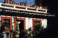
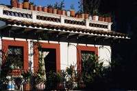
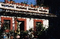
| dc.description | Hotel Santa Prisca, near Templo de Santa Prisca; Taxco de Alarcón (Taxco) is a former colonial silver-mining center (incorporated in 1532) in the northern part of the Mexican state of Guerrero on the western arm of the Sierra Madre del Sur. It is located 200 km southwest of Mexico City along the old highway to Acapulco at an elevation of 1,800 m (5,900 ft). The city serves as the administrative center of the municipality of the same name, which covers a total area of 347 km2 (134 sq mi) of the surrounding territory. The city is built on the side of a mountain, with very steep narrow cobblestone streets lined by whitewashed houses with red-tiled roofs. Source: Wikipedia; http://en.wikipedia.org/wiki/Main_Page (accessed 6/21/2009) | en_US |
| dc.format.medium | digital photography | en_US |
| dc.rights | © Scott Gilchrist, Archivision, Inc. | en_US |
| dc.subject | architectural exteriors | en_US |
| dc.subject | cityscapes | en_US |
| dc.subject | contemporary (1960 to present) | en_US |
| dc.subject | landscapes | en_US |
| dc.subject | Twentieth century | en_US |
| dc.title | Taxco: Topographic Views | en_US |
| dc.title.alternative | Overview of Taxco de Alarcón | en_US |
| dc.type | image | en_US |
| dc.rights.access | Licensed for educational and research use by the MIT community only | en_US |
| dc.identifier.vendorcode | 1A2-M-TA-TO-A14 | en_US |
| vra.culturalContext | Mexican | en_US |
| vra.technique | photography | en_US |
| vra.worktype | topographical view | en_US |
| vra.worktype | photograph | en_US |
| dc.contributor.display | Scott Gilchrist (Canadian photographer, born 1960) | en_US |


