| dc.coverage.spatial | Site: Veneto (Italy) | en_US |
| dc.creator | Unknown | en_US |
| dc.date | Unavailable | en_US |
| dc.date.accessioned | 2010-11-19T21:42:32Z | |
| dc.date.available | 2010-11-19T21:42:32Z | |
| dc.date.issued | Unavailable | en_US |
| dc.identifier | 149554 | en_US |
| dc.identifier.uri | http://hdl.handle.net/1721.3/57893 | en_US |
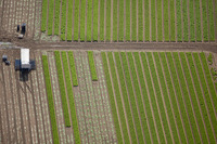
| dc.description | aerial view, agricultural land with crops planted and harvested, 10/2/2009 | en_US |
| dc.relation.ispartof | 140301 | en_US |
| dc.rights | © Alex S. MacLean / Landslides | en_US |
| dc.subject | Urban planning | en_US |
| dc.subject | Land use | en_US |
| dc.subject | Cities and towns -- Italy | en_US |
| dc.subject | City planning -- Italy | en_US |
| dc.subject | Veneto (Italy) | en_US |
| dc.subject | Plants | en_US |
| dc.subject | Agricultural land | en_US |
| dc.subject | Farm equipment | en_US |
| dc.title | City of Cavallino-Treporti | en_US |
| dc.type | Image | en_US |
| dc.rights.access | Licensed for educational and research use by the MIT community only | en_US |
| dc.identifier.vendorcode | 091002-0744 | en_US |
| vra.culturalContext | Italian | en_US |
| vra.technique | construction | en_US |
| vra.worktype | City | en_US |
| dc.contributor.display | Italian | en_US |