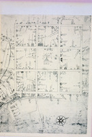
Plan of New Haven
| dc.coverage.spatial | Site: New Haven (Connecticut, USA) | en_US |
| dc.coverage.temporal | Creation date: ca. 1600-ca. 1800 | en_US |
| dc.creator | unknown (American) | en_US |
| dc.date | ca. 1600-ca. 1800 | en_US |
| dc.date.accessioned | 2006-09-22T05:16:09Z | |
| dc.date.available | 2006-09-22T05:16:09Z | |
| dc.date.issued | 1600-1800 | en_US |
| dc.identifier | 102491 | en_US |
| dc.identifier.uri | http://hdl.handle.net/1721.3/5316 | en_US |
| dc.description | map, 1748 | en_US |
| dc.relation.ispartof | 127460 | en_US |
| dc.subject | Planned communities | en_US |
| dc.subject | Urban planning | en_US |
| dc.subject | United States --History --Colonial period, ca. 1600-1775 | en_US |
| dc.subject | Yale University | en_US |
| dc.subject | Cities and towns --Growth | en_US |
| dc.subject | Land use, Urban | en_US |
| dc.subject | New Haven (Conn.) | en_US |
| dc.title | Plan of New Haven | en_US |
| dc.type | Image | en_US |
| dc.rights.access | All rights reserved | en_US |
| vra.culturalContext | American | en_US |
| vra.worktype | Historical map | en_US |
| dc.contributor.display | unknown (American) | en_US |
Files in this item
This item appears in the following Collection(s)
-
Architecture, Urban Planning, and Visual Arts
Online Image Collection


