
Mohave County
| dc.coverage.spatial | Site: Mohave County (Arizona, United States) | en_US |
| dc.creator | Unknown | en_US |
| dc.date | Unavailable | en_US |
| dc.date.accessioned | 2009-10-23T19:50:56Z | |
| dc.date.available | 2009-10-23T19:50:56Z | |
| dc.date.issued | Unavailable | en_US |
| dc.identifier | 130486 | en_US |
| dc.identifier.uri | http://hdl.handle.net/1721.3/44588 | en_US |
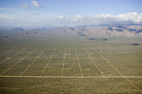
| dc.description | aerial view, desert grid | en_US |
| dc.relation.ispartof | 138209 | en_US |
| dc.rights | © Alex S. MacLean / Landslides | en_US |
| dc.subject | Deserts | en_US |
| dc.subject | Southwest (U.S.) | en_US |
| dc.subject | Arizona | en_US |
| dc.subject | Counties | en_US |
| dc.subject | Grids (layout features) | en_US |
| dc.subject | Aerial photography --United States | en_US |
| dc.title | Mohave County | en_US |
| dc.type | Image | en_US |
| dc.rights.access | Licensed for educational and research use by the MIT community only | en_US |
| dc.identifier.vendorcode | 050213-0050.tif | en_US |
| vra.culturalContext | American | en_US |
| vra.worktype | County | en_US |
| dc.contributor.display | American | en_US |
Files in this item


This item appears in the following Collection(s)
-
Aerial Photography
Aerial Photography