| dc.coverage.spatial | Site: Quincy (Massachusetts, United States) | en_US |
| dc.coverage.temporal | creation date: first settled, 1625, creation date: separated from Braintree, 1792, creation date: became a city, 1888 | en_US |
| dc.creator | Unknown | en_US |
| dc.date | 1625 | en_US |
| dc.date.accessioned | 2009-10-23T18:35:13Z | |
| dc.date.available | 2009-10-23T18:35:13Z | |
| dc.date.issued | 1625 | en_US |
| dc.identifier | 130325 | en_US |
| dc.identifier.uri | http://hdl.handle.net/1721.3/44347 | en_US |
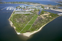
| dc.description | aerial view, Squantum Point Park, 5/12/2005 | en_US |
| dc.relation.ispartof | 138259 | en_US |
| dc.rights | © Alex S. MacLean / Landslides | en_US |
| dc.subject | Suburbs | en_US |
| dc.subject | Land use, Urban | en_US |
| dc.subject | City planning | en_US |
| dc.subject | Cities and towns -- United States | en_US |
| dc.subject | Urban parks | en_US |
| dc.subject | Aerial photography --United States | en_US |
| dc.title | City of Quincy | en_US |
| dc.type | Image | en_US |
| dc.rights.access | Licensed for educational and research use by the MIT community only | en_US |
| dc.identifier.vendorcode | 050512-0014.tif | en_US |
| vra.culturalContext | American | en_US |
| vra.worktype | City | en_US |
| dc.contributor.display | American | en_US |