| dc.coverage.spatial | Site: Boston (Massachusetts, United States) | en_US |
| dc.coverage.temporal | creation date: annexed by Boston, 1836 | en_US |
| dc.creator | Unknown | en_US |
| dc.date | 1836 | en_US |
| dc.date.accessioned | 2009-10-23T18:32:56Z | |
| dc.date.available | 2009-10-23T18:32:56Z | |
| dc.date.issued | 1836 | en_US |
| dc.identifier | 130290 | en_US |
| dc.identifier.uri | http://hdl.handle.net/1721.3/44319 | en_US |
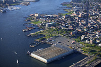
| dc.description | aerial view, East Boston, as situated on Boston Harbor, 8/26/2004 | en_US |
| dc.relation.ispartof | 135290 | en_US |
| dc.rights | © Alex S. MacLean / Landslides | en_US |
| dc.subject | Urban planning | en_US |
| dc.subject | Neighborhoods | en_US |
| dc.subject | Land use, Urban | en_US |
| dc.subject | City planning | en_US |
| dc.subject | East Boston (Boston, Mass.) | en_US |
| dc.subject | Harbors | en_US |
| dc.subject | Wharves | en_US |
| dc.subject | Boston Harbor (Mass.) | en_US |
| dc.subject | Aerial photography --United States | en_US |
| dc.title | East Boston | en_US |
| dc.type | Image | en_US |
| dc.rights.access | Licensed for educational and research use by the MIT community only | en_US |
| dc.identifier.vendorcode | 30AX0085.tif | en_US |
| vra.culturalContext | American | en_US |
| vra.technique | construction | en_US |
| vra.worktype | Neighborhood | en_US |
| dc.contributor.display | American | en_US |