| dc.coverage.temporal | creation date: satellite pictures, October 1972-March 1973, publication date: ca. 1973 | en_US |
| dc.creator | United States. National Aeronautics and Space Administration | en_US |
| dc.creator | Sathāban Wičhai Witthayāsāt Prayuk hæng Prathēt Thai | en_US |
| dc.creator | Krom Pāmai | en_US |
| dc.creator | United States Operations Mission to Thailand | en_US |
| dc.date | October 1972-March 1973 | en_US |
| dc.date.accessioned | 2009-03-02T14:23:40Z | |
| dc.date.available | 2009-03-02T14:23:40Z | |
| dc.date.issued | 1972-1973 | en_US |
| dc.identifier | 126143 | en_US |
| dc.identifier.uri | http://hdl.handle.net/1721.3/36287 | en_US |
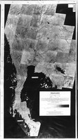
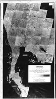
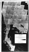
| dc.description | full view, Assembled from pictures produced at an altitude of 914 km by the first NASA Earth Resources Technology Satellite (ERTS-1) during the period October 1972 to March 1973. Image were reconstructed from magnetic tape recordings of data received by the ERTS-1 multispectral scanner in near-infrared band 7 (0.8-1.1 micron wavelength band) | en_US |
| dc.format.extent | 92 x 52 cm (36.22 x 20.47 inches) | en_US |
| dc.relation.ispartof | 136927 | en_US |
| dc.subject | Cartography | en_US |
| dc.subject | Thailand | en_US |
| dc.subject | Thailand--Remote-sensing maps | en_US |
| dc.subject | Landsat satellites | en_US |
| dc.subject | Earth resources technology satellites | en_US |
| dc.title | Thailand: Experimental Satellite Photomap | en_US |
| dc.type | Image | en_US |
| dc.rights.access | All rights reserved | en_US |
| vra.culturalContext | Thai | en_US |
| vra.technique | printing | en_US |
| vra.worktype | Photomap | en_US |
| dc.contributor.display | cartographer: images by United States. National Aeronautics and Space Administration (American, 1958-), cartographer: prints and mosaic construction by Sathāban Wičhai Witthayāsāt Prayuk hæng Prathēt Thai (Thai, 1963-1979), cartographer: gray scale print by Krom Pāmai (Thai, 1896-), supervisor: technical supervision by United States Operations Mission to Thailand (American, active 1950s-1970s) | en_US |


