Browsing Perceptual Form of the City by Title
Now showing items 1310-1329 of 2194
-
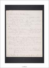
Of Interest to Study, Boston Area
(Massachusetts Institute of Technology, Institute Archives and Special Collections, 1954 - 195) -
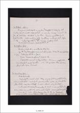
Office and Field Interview Notes
(Massachusetts Institute of Technology, Institute Archives and Special Collections, 1955) -
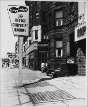
The Office Composing Machine Sign
(Repository: Rotch Visual Collections, Massachusetts Institute of Technology (Cambridge, Massachusetts, United States) ID: Kepes/Lynch Collection, 18.29, 1955) -
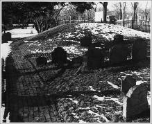
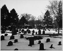
Old Burying Ground, Cambridge Common in Background
(Repository: Rotch Visual Collections, Massachusetts Institute of Technology (Cambridge, Massachusetts, United States) ID: Kepes/Lynch Collection, 54.52, 1954-1959) -
Old Burying Ground, Cambridge Common in Background
(Repository: Rotch Visual Collections, Massachusetts Institute of Technology (Cambridge, Massachusetts, United States) ID: Kepes/Lynch Collection, 54.54, 1954-1959) -
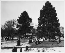
Old Burying Ground, Cambridge, Facing North
(Repository: Rotch Visual Collections, Massachusetts Institute of Technology (Cambridge, Massachusetts, United States) ID: Kepes/Lynch Collection, 54.57A, 1954-1959) -
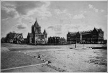
Old Copy of Copley Square
(Repository: Rotch Visual Collections, Massachusetts Institute of Technology (Cambridge, Massachusetts, United States) ID: Kepes/Lynch Collection, 11.01, 1841-1915) -
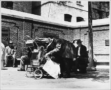
Old Man Leaning over Infant in Stroller, Paul Revere Mall
(Repository: Rotch Visual Collections, Massachusetts Institute of Technology (Cambridge, Massachusetts, United States) ID: Kepes/Lynch Collection, 57.10, 1954-1959) -
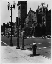
Old South Church From the Corner of Dartmouth and Boylston Streets
(Repository: Rotch Visual Collections, Massachusetts Institute of Technology (Cambridge, Massachusetts, United States) ID: Kepes/Lynch Collection, 14.18, 1954-1959) -
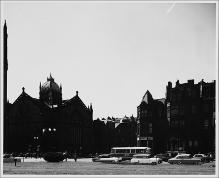
Old South Church, Left of Center, View from Center of Copley Square, 3:15 to 3:45 P.M.
(Repository: Rotch Visual Collections, Massachusetts Institute of Technology (Cambridge, Massachusetts, United States) ID: Kepes/Lynch Collection, 20.04, 1954-1959) -
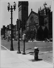
Old South Church, Street Furniture on the Corner of Boylston and Dartmouth Street
(Repository: Rotch Visual Collections, Massachusetts Institute of Technology (Cambridge, Massachusetts, United States) ID: Kepes/Lynch Collection, 18.18, 1954-1959) -
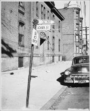
One Way, Do Not Enter Signs, School Street
(Repository: Rotch Visual Collections, Massachusetts Institute of Technology (Cambridge, Massachusetts, United States) ID: Kepes/Lynch Collection, 69.13, 1954-1959) -
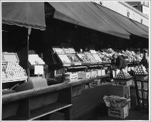
Open Air Fruit and Vegetable Market, Produce Displays, Cross Street
(Repository: Rotch Visual Collections, Massachusetts Institute of Technology (Cambridge, Massachusetts, United States) ID: Kepes/Lynch Collection, 53.06, 1957) -
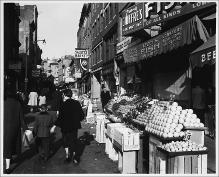
Open Air Fruit and Vegetable Market, Salem Street
(Repository: Rotch Visual Collections, Massachusetts Institute of Technology (Cambridge, Massachusetts, United States) ID: Kepes/Lynch Collection, 53.10, 1957) -
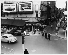
Open Air Markets and Storefronts, Corner of Union and Salem Streets
(Repository: Rotch Visual Collections, Massachusetts Institute of Technology (Cambridge, Massachusetts, United States) ID: Kepes/Lynch Collection, 53.12, 1954-1959) -
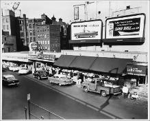
Open Air Markets and Storefronts, Union Street
(Repository: Rotch Visual Collections, Massachusetts Institute of Technology (Cambridge, Massachusetts, United States) ID: Kepes/Lynch Collection, 53.11, 1954-1959) -
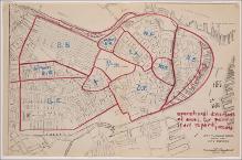
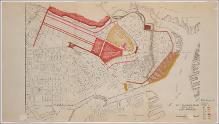
Operational Definitions of Area for Preliminary Report, Recon.
(Massachusetts Institute of Technology, Institute Archives and Special Collections, 1959) -
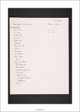
Order & Frequency of Drawing
(Massachusetts Institute of Technology, Institute Archives and Special Collections, 1959) -
Orenberg Base Map (Interview) and Drawn Map
(Massachusetts Institute of Technology, Institute Archives and Special Collections, 1954 - 195) -
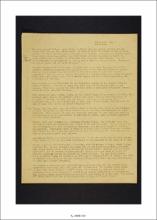
Orientation (December)
(Massachusetts Institute of Technology, Institute Archives and Special Collections, 1955)