
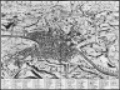
Duchet's Historic map of Rome, 1582
| dc.coverage.spatial | Site: Rome (Italy) | en_US |
| dc.coverage.temporal | Creation date: ca. 1582 | en_US |
| dc.creator | Duchet, Claude | en_US |
| dc.date | ca. 1582 | en_US |
| dc.date.accessioned | 2006-10-04T20:31:14Z | |
| dc.date.available | 2006-10-04T20:31:14Z | |
| dc.date.issued | 1577-1587 | en_US |
| dc.identifier | 100668 | en_US |
| dc.identifier.uri | http://hdl.handle.net/1721.3/3188 | en_US |
| dc.description | full view | en_US |
| dc.format.medium | paper (fiber product) | en_US |
| dc.format.medium | ink | en_US |
| dc.relation.ispartof | 126911 | en_US |
| dc.subject | Rome (Italy) | en_US |
| dc.subject | Urban planning | en_US |
| dc.subject | Cities and towns | en_US |
| dc.subject | Historical geography --Maps | en_US |
| dc.subject | Land use, Urban | en_US |
| dc.subject | City planning | en_US |
| dc.subject | Engraving, French | en_US |
| dc.subject | Art, Late Renaissance | en_US |
| dc.subject | Architecture -- Italy | en_US |
| dc.title | Duchet's Historic map of Rome, 1582 | en_US |
| dc.title.alternative | Urbis Romae Descriptio | en_US |
| dc.type | Image | en_US |
| dc.rights.access | All rights reserved | en_US |
| vra.culturalContext | Italian | en_US |
| vra.technique | engraving (printing process) | en_US |
| vra.worktype | Historical map | en_US |
| dc.contributor.display | engraver: Claude Duchet (French, 1520-ca. 1585) | en_US |
Files in this item


This item appears in the following Collection(s)
-
Architecture, Urban Planning, and Visual Arts
Online Image Collection