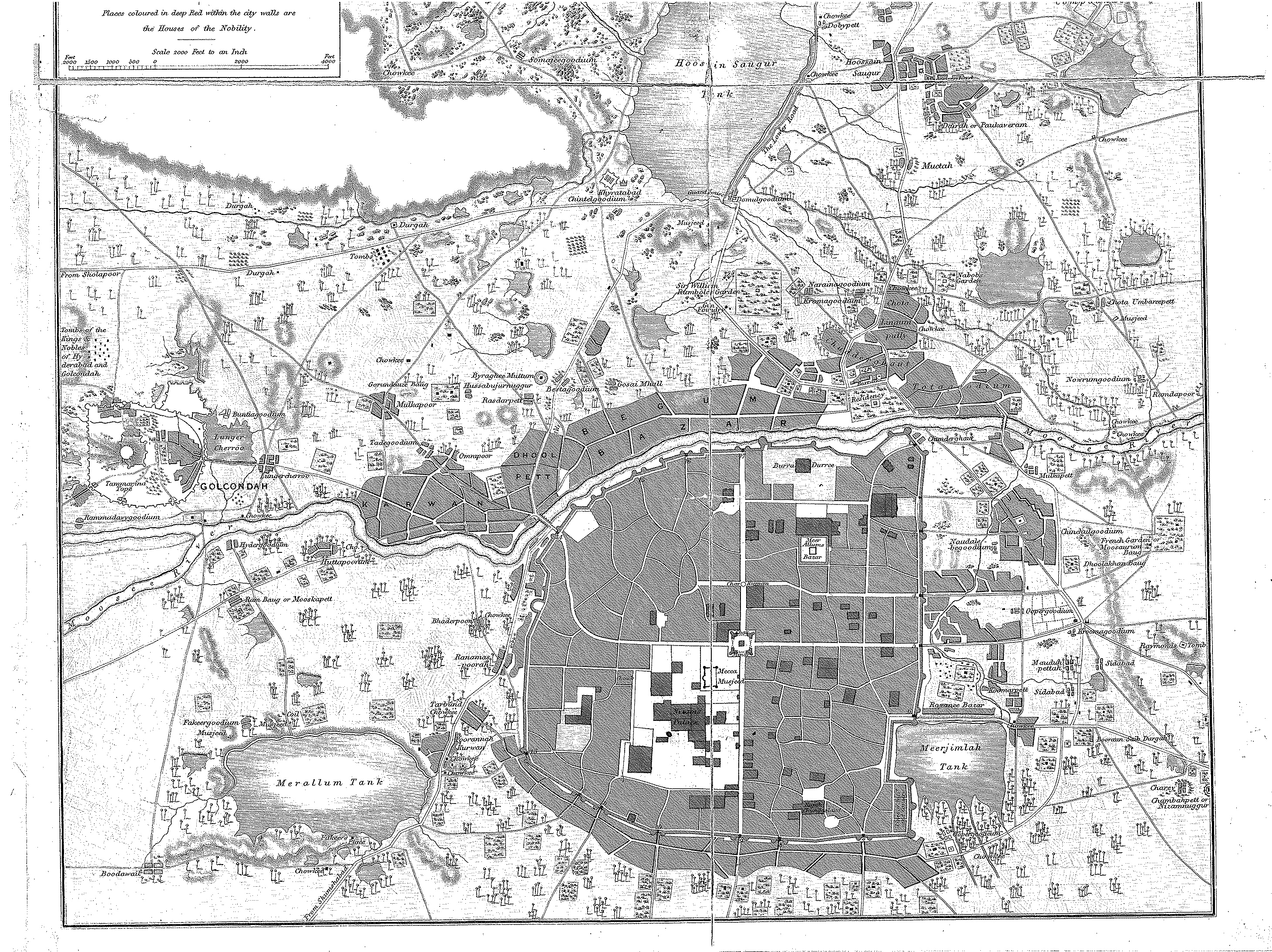
| dc.coverage.spatial | Creation location: Hyderabad (Andhra Pradesh, India) | en_US |
| dc.creator | Pharaoh and Co. | en_US |
| dc.date.accessioned | 2008-06-23T20:10:39Z | |
| dc.date.available | 2008-06-23T20:10:39Z | |
| dc.identifier | 118968 | en_US |
| dc.identifier.uri | http://hdl.handle.net/1721.3/27199 | en_US |
| dc.description | detail, bottom portion of map | en_US |
| dc.format.medium | paper (fiber product) | en_US |
| dc.format.medium | ink | en_US |
| dc.relation.ispartof | 130031 | en_US |
| dc.subject | Cartography | en_US |
| dc.subject | India | en_US |
| dc.subject | Mughal | en_US |
| dc.subject | Islamic cities and towns | en_US |
| dc.subject | Historical geography --Maps | en_US |
| dc.subject | Land use, Urban | en_US |
| dc.subject | Hyderabad (India) | en_US |
| dc.title | Plan of the City and Environs of Hyderabad | en_US |
| dc.type | Image | en_US |
| vra.culturalContext | Indian (South Asian) | en_US |
| vra.technique | cartography | en_US |
| vra.worktype | Map | en_US |
| dc.contributor.display | cartographer: Pharaoh and Co. (Indian (South Asian), 19th century) | en_US |