| dc.coverage.temporal | creation date: 1965-1966 | en_US |
| dc.creator | Johns, Jasper | en_US |
| dc.creator | Universal Limited Art Editions | en_US |
| dc.date | 1965-1966 | en_US |
| dc.date.accessioned | 2008-02-28T17:57:26Z | |
| dc.date.available | 2008-02-28T17:57:26Z | |
| dc.date.issued | 1965-1966 | en_US |
| dc.identifier | 110659 | en_US |
| dc.identifier.uri | http://hdl.handle.net/1721.3/25000 | en_US |
| dc.description | full view | en_US |
| dc.format.extent | 83.8 x 67.3 cm (32.99 x 26.5 inches) | en_US |
| dc.format.medium | paper (fiber product) | en_US |
| dc.format.medium | ink | en_US |
| dc.relation.ispartof | 132597 | en_US |
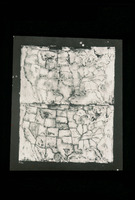
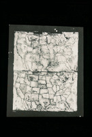
| dc.subject | Cartography | en_US |
| dc.subject | Geography | en_US |
| dc.subject | United States -- Maps | en_US |
| dc.subject | Pop art --United States | en_US |
| dc.subject | Art, Modern --20th century | en_US |
| dc.title | Two Maps I | en_US |
| dc.type | Image | en_US |
| dc.rights.access | All rights reserved | en_US |
| vra.culturalContext | American | en_US |
| vra.technique | lithography | en_US |
| vra.worktype | Lithograph | en_US |
| dc.contributor.display | lithographer: Jasper Johns (American, 1930-), publisher: Universal Limited Art Editions (American, 1957-) | en_US |


