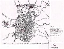
Land Use Map of Hyderabad and Secunderabad in 1915
City Improvement Board

Download109537_cp.jpg (2.318Mb)
Description
full view, showing agricultural, residential, commercial, public and semi-public lands, parks and public grounds as well as burial and cremation grounds.
Type of Work
MapSubject
Cartography, India, Islamic cities and towns, Historical geography --Maps, Land use, Urban, Hyderabad (India), Secunderābād (India)
Rights Statement
All rights reserved
Item is Part of
130036