
Plan for the Valleys
| dc.coverage.temporal | publication date: 1964 | en_US |
| dc.creator | Wallace-McHarg Associates | en_US |
| dc.date | 1964 | en_US |
| dc.date.accessioned | 2015-11-03T19:00:50Z | |
| dc.date.available | 2015-11-03T19:00:50Z | |
| dc.date.issued | 1964 | en_US |
| dc.identifier | 260260 | en_US |
| dc.identifier.uri | http://hdl.handle.net/1721.3/175667 | |
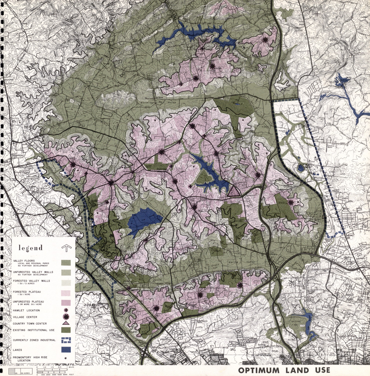
| dc.description | map, optimum land use | en_US |
| dc.relation.ispartof | 144709 | en_US |
| dc.subject | Urban planning | en_US |
| dc.subject | City planning -- Maryland | en_US |
| dc.subject | Regional planning -- Maryland | en_US |
| dc.subject | Green Spring Valley (Md.) | en_US |
| dc.subject | Worthington Valley (Md.) | en_US |
| dc.subject | Land use | en_US |
| dc.subject | Thematic maps | en_US |
| dc.title | Plan for the Valleys | en_US |
| dc.type | Image | en_US |
| dc.identifier.vendorcode | PlanForTheValleys_009 | en_US |
| vra.culturalContext | American | en_US |
| vra.worktype | Municipal plan | en_US |
| dc.contributor.display | Architectural firm: Wallace-McHarg Associates (American, 1962-1964) | en_US |
Files in this item

This item appears in the following Collection(s)
-
Selected City Plans
Selected City Plans