| dc.coverage.temporal | creation date: ca. 1987 | en_US |
| dc.creator | Unknown | en_US |
| dc.date | ca. 1987 | en_US |
| dc.date.accessioned | 2014-03-19T18:42:20Z | |
| dc.date.available | 2014-03-19T18:42:20Z | |
| dc.date.issued | 1982-1992 | en_US |
| dc.identifier | 166967 | en_US |
| dc.identifier.uri | http://hdl.handle.net/1721.3/161545 | |
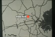
| dc.description | Potter Pond St., Lexington, MA 02420 | en_US |
| dc.description | full view | en_US |
| dc.relation.ispartof | 142370 | en_US |
| dc.rights | (c) Massachusetts Institute of Technology | en_US |
| dc.subject | Suburbs | en_US |
| dc.subject | Housing developments | en_US |
| dc.subject | Lexington (Mass.) | en_US |
| dc.subject | Massachusetts -- Maps | en_US |
| dc.subject | Boston Suburbs - Chapter 6 | en_US |
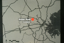
| dc.title | Map of Boston Area Indicating Location of Potter Pond in Lexington | en_US |
| dc.type | Image | en_US |
| dc.rights.access | Creative Commons Attribution-NonCommercial 3.0 http://creativecommons.org/licenses/by-nc/3.0/ | en_US |
| dc.identifier.vendorcode | 6.542 | en_US |
| vra.culturalContext | American | en_US |
| vra.worktype | Map | en_US |
| dc.contributor.display | American | en_US |


