| dc.coverage.spatial | Site: Somerville (Massachusetts, United States) | en_US |
| dc.coverage.temporal | other date: first survey by Charles Whitney, 1847, other date: plan by Samuel Chamberlain, 1853, other date: Y-shaped plan, Charles Robinson, 1890 | en_US |
| dc.creator | Unknown | en_US |
| dc.date | 1847 | en_US |
| dc.date.accessioned | 2014-02-19T17:34:21Z | |
| dc.date.available | 2014-02-19T17:34:21Z | |
| dc.date.issued | 1847 | en_US |
| dc.identifier | 160607 | en_US |
| dc.identifier.uri | http://hdl.handle.net/1721.3/157844 | |
| dc.description | Post Civil War settlement stimulated by frequent commuter service (59 week-day trains by 1886). | en_US |
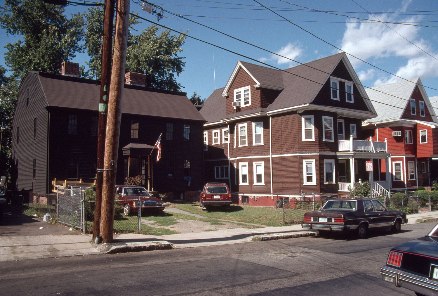
| dc.description | general view, Peter and Oliver Tufts house (1714), 78 Sycamore Street, 1988 | en_US |
| dc.relation.ispartof | 141475 | en_US |
| dc.rights | (c) Massachusetts Institute of Technology | en_US |
| dc.subject | Suburbs | en_US |
| dc.subject | Urban areas | en_US |
| dc.subject | Land use, Urban | en_US |
| dc.subject | Architecture, Domestic --United States | en_US |
| dc.subject | Somerville (Mass.) | en_US |
| dc.subject | Ethnic neighborhoods | en_US |
| dc.subject | Residential districts | en_US |
| dc.subject | Historic houses | en_US |
| dc.subject | Single-family dwellings | en_US |
| dc.subject | Boston Suburbs - Chapter 2 - 1865-1910 | en_US |
| dc.title | Winter Hill | en_US |
| dc.type | Image | en_US |
| dc.rights.access | Creative Commons Attribution-NonCommercial 3.0 http://creativecommons.org/licenses/by-nc/3.0/ | en_US |
| dc.identifier.vendorcode | 2.1098 | en_US |
| vra.culturalContext | American | en_US |
| vra.technique | construction | en_US |
| vra.worktype | Neighborhood | en_US |
| dc.contributor.display | American | en_US |