| dc.coverage.spatial | Site: Edinburgh, Scotland, United Kingdom | en_US |
| dc.coverage.temporal | 1837 (creation) | en_US |
| dc.creator | Scott, Robert | en_US |
| dc.date | 1837 | en_US |
| dc.date.accessioned | 2013-10-03T14:41:01Z | |
| dc.date.available | 2013-10-03T14:41:01Z | |
| dc.date.issued | 1837 | en_US |
| dc.identifier | 236878 | en_US |
| dc.identifier.other | archrefid: 2573 | en_US |
| dc.identifier.uri | http://hdl.handle.net/1721.3/144629 | |
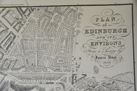
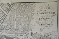
| dc.description | Detail, upper right corner with title; Great London Road and Royal Terrace roads running horizontally along bottom; Scale [ca. 1:6,000]. Created from a survey by James Knox, engraved by R. Scott. Shows streets, monuments and topographical, geological features, circa. 1837. Areas of town are given large Roman numerals, explained in a key which also gives population statistics and index to churches. Relief shown by hachures and spot heights. Published in Edinburgh. [ Information from University of South Florida Libraries http://digital.lib.usf.edu/?u16.91 ] | en_US |
| dc.format.medium | ink on paper | en_US |
| dc.rights | © Scott Gilchrist, Archivision, Inc. | en_US |
| dc.subject | architecture | en_US |
| dc.subject | cityscape | en_US |
| dc.subject | City planning | en_US |
| dc.subject | Nineteenth century | en_US |
| dc.title | Plan of Edinburgh and Its Environs, From a Survey by John Knox | en_US |
| dc.title.alternative | Plan of Edinburgh and Its Environs | en_US |
| dc.type | image | en_US |
| dc.rights.access | Licensed for educational and research use by the MIT community only | en_US |
| dc.identifier.vendorcode | 1A2-SC-E-POE-AA11 | en_US |
| vra.culturalContext | British Scottish (Scots) | en_US |
| vra.technique | engraving (printing process) | en_US |
| vra.worktype | map | en_US |
| vra.worktype | site plan | en_US |
| vra.worktype | engraving (print) | en_US |
| dc.contributor.display | Robert Scott (British engraver, 1771-1841) | en_US |


