| dc.coverage.spatial | Creation Site: San Miguel de Allende, Guanajuato, Mexico, North and Central America, | en_US |
| dc.coverage.temporal | 2011 (creation) | en_US |
| dc.creator | Gilchrist, Scott | en_US |
| dc.date | 2011 | en_US |
| dc.date.accessioned | 2013-09-26T20:11:39Z | |
| dc.date.available | 2013-09-26T20:11:39Z | |
| dc.date.issued | 2011 | en_US |
| dc.identifier | 236595 | en_US |
| dc.identifier.other | archrefid: 2559 | en_US |
| dc.identifier.uri | http://hdl.handle.net/1721.3/144330 | |
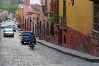
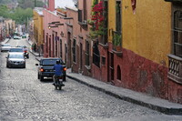
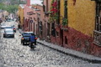
| dc.description | View down cobblestone street, with houses adjusting to the steep grade; Located in the far eastern part of the state of Guanajuato in central Mexico, 274 km from Mexico City. As of the 2005 census, the population stood at 139,297. Since WWII, the town has attracted a very large number of foreign retirees, artists, writers and tourists, which is shifting the area’s economy from agriculture and industry to commerce catering to outside visitors and residents, who make up about 10 percent of the population. The main attraction of the town is its well-preserved historic center, filled with buildings from the 17th and 18th centuries. This and the nearby Sanctuary of Atotonilco have been declared World Heritage Sites. Source: Wikipedia; http://en.wikipedia.org/wiki/Main_Page (accessed 7/16/2012) | en_US |
| dc.format.medium | digital images | en_US |
| dc.rights | © Scott Gilchrist, Archivision, Inc. | en_US |
| dc.subject | architecture | en_US |
| dc.subject | cityscape | en_US |
| dc.subject | City planning | en_US |
| dc.subject | Twenty-first century | en_US |
| dc.title | San Miguel de Allende: Topographic Views | en_US |
| dc.type | image | en_US |
| dc.rights.access | Licensed for educational and research use by the MIT community only | en_US |
| dc.identifier.vendorcode | 1A2-M-SMA-TV-A4 | en_US |
| vra.culturalContext | Mexican | en_US |
| vra.technique | photography | en_US |
| vra.worktype | topographical view | en_US |
| vra.worktype | photograph | en_US |
| dc.contributor.display | Scott Gilchrist (Canadian photographer, born 1960) | en_US |


