| dc.coverage.spatial | Creation Site: Las Vegas, Nevada, United States, North and Central America, | en_US |
| dc.coverage.temporal | March 2010 (creation) | en_US |
| dc.creator | Gilchrist, Scott | en_US |
| dc.date | 2010 | en_US |
| dc.date.accessioned | 2013-08-15T16:21:15Z | |
| dc.date.available | 2013-08-15T16:21:15Z | |
| dc.date.issued | 2010 | en_US |
| dc.identifier | 230743 | en_US |
| dc.identifier.other | archrefid: 2497 | en_US |
| dc.identifier.uri | http://hdl.handle.net/1721.3/138527 | |
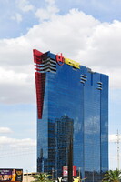
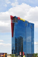
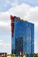
| dc.description | PH Towers Westgate, a new tower of the Planet Hollywood complex; Views taken in 2010 on Las Vegas Boulevard South, looking North in the area around W. Harmon Street. At the point the Boulevard leaves the city of Las Vegas it assumes its unofficial name the Las Vegas Strip for the next four miles (6 km). This portion of Las Vegas Boulevard begins at the Stratosphere and runs to Mandalay Bay. This is the section of the road most people are familiar with; it is home to casino megaresorts Source: Wikipedia; http://en.wikipedia.org/wiki/Main_Page (accessed 4/27/2011) | en_US |
| dc.format.medium | digital images | en_US |
| dc.rights | © Scott Gilchrist, Archivision, Inc. | en_US |
| dc.subject | architecture | en_US |
| dc.subject | business, commerce and trade | en_US |
| dc.subject | cityscape | en_US |
| dc.subject | contemporary (1960 to present) | en_US |
| dc.subject | City planning | en_US |
| dc.subject | Performing arts | en_US |
| dc.subject | gaming | en_US |
| dc.subject | gambling | en_US |
| dc.subject | resorts | en_US |
| dc.subject | entertainment | en_US |
| dc.subject | Twenty-first century | en_US |
| dc.title | Las Vegas: Topographic Views of the North Strip | en_US |
| dc.type | image | en_US |
| dc.rights.access | Licensed for educational and research use by the MIT community only | en_US |
| dc.identifier.vendorcode | 1A2-LV-US-NS-A4 | en_US |
| vra.culturalContext | American | en_US |
| vra.technique | photography | en_US |
| vra.worktype | photograph | en_US |
| vra.worktype | topographical view | en_US |
| dc.contributor.display | Scott Gilchrist (Canadian photographer, born 1960) | en_US |


